
Free Shipping
on most orders over $99
AO Rewards
Earn 2% on every purchase
Price Guarantee
We match advertised prices
Product details
In addition to a selection of paddling routes through large and small lakes, there are several great river routes, and even the chance to hike to the highest elevation in Ontario, Ishpatina Peak. This 1:80,000 scale map, features parts of 5 different provincial parks, as well as several conservation reserves.
The Adventure Map Temagami 4 Northwest & Sturgeon River
- Scale : 1:80,000
- Waterproof
- Map features: western portion of Lady Evelyn Smoothwater P.P plus solace lake P.P Sturgeon River P.P Obabika River P.P Ishpatina Ridge, access points campsites, portages, historic sites, route descriptions and more.
- Back Side: Providing local history, route descriptions, safety issues, contact and other information to help you plan and take your trip
Loaded with Info
The Adventure Map isn’t just an exceptionally good topographic recreation map; The back is also filled with colour photos, important information about the area including natural and human history, local regulations, outdoor tips, safety concerns, addresses, useful phone numbers and more.
Related Products

GSI OUTDOORS
Halulite Cook Pot 3.2L
$55.98
ESKER
Bucksaw 24″ Walnut With Bag
$224.00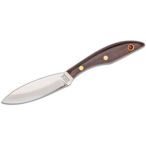
GROHMANN
Belt Ss Rosewood Blade R1S Original
$109.98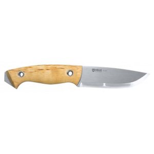
HELLE
Utvaer Tool
$305.75
ESKER
Bucksaw 24″ Maple
$149.00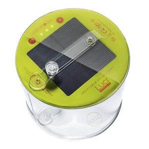
LUCI
Outdoor 2.0 Inflatable Solar Lantern
$35.00
MSR
Fuel Bottle Crp Cap 30 Oz
$36.95
PRIMUS